Rotating motion on a supercell thunderstorm with cloud structure and lightning.
john finney photography/Getty Images
Updated: 3:15 p.m. April 22, 2025
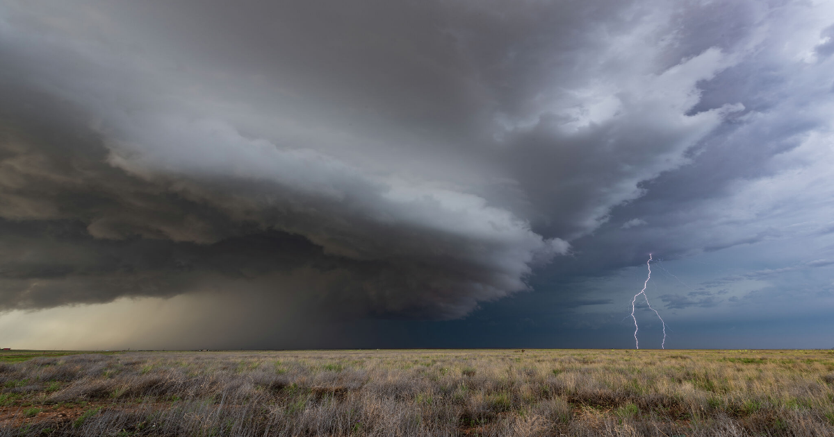
As the first system rolls in bringing hail, heavy rain and even a very minor tornado threat to Texas, a severe thunderstorm watch has been issued for most of West Texas and the Texas Panhandle. In an usually large watch area, the National Weather Service says tornadoes, tennis-ball sized hail and 75 mph winds could form anywhere from Del Rio to Fort Stockton all the way up to the Texas and Oklahoma panhandle border.

Article continues below this ad
The severe thunderstorm watch will remain in effect until 11 p.m. Tuesday night, April 22. Though, more storms are forecast for the rest of the week as a series of systems roll through creating more chances for severe storms.
It’s going to be a stormy week for a large swath of Texas from the Panhandle, across North Texas and into South Central Texas. The National Weather Service is signaling rain chances for these regions throughout the week amid a series of systems which could spell damaging weather for Texas.
A cold front brought stormy weather to the Lone Star State over the weekend. But as this front moves north, warm and wet air will move into the state and bring more thunderstorm odds. In fact, they could bring strong to severe storms with hail, wind and flooding chances.

Article continues below this ad
“A storm system shifting across the Great Lakes will bring light to moderate snow over parts of [the] region today. Further south, scattered showers and thunderstorms are expected along and ahead of a cold front from Michigan to east Texas,” the National Weather Service warns.
The Storm Prediction Center currently has the entire state of Texas under a Level 1 (marginal risk) of severe storms, though West Texas and the Texas Panhandle have higher risk levels on Tuesday and into Wednesday.
After sunny yet cool days in Panhandle towns like Amarillo and Dalhart, the National Weather Service is warning residents to brace for severe storms. A combination of systems spells a large hail and damaging wind threat for the region.

Article continues below this ad
“All good things must come to an end however, as we appear to have our first bona fide severe threat of the season across much of the area on Tuesday,” the National Weather Service Amarillo office warns.
The first wave of thunderstorms are set to hit Tuesday afternoon into the evening. A 50% chance of thunderstorms continues through evening and climbs to 60% by Wednesday morning and afternoon. A second system could spell continued severe storm threats for the Panhandle well into the weekend.
“If a cold front holds to our north through the day, we’ll be monitoring for strong-severe storm potential. If the front comes barreling through early (as they often do), then general convective thunderstorms along and behind the front would be more likely,” the national forecaster says, warning Thursday could spell another day of hail and heavy rains.
A lingering cold front that brought a decent cool down for Easter Sunday lifted back north Tuesday morning allowing a warm front with high moisture to sweep in. With it comes the chance of either isolated or scattered showers across South Central Texas, including San Antonio, Austin and the Texas Hill Country.
Article continues below this ad
This should all happen no sooner than Tuesday afternoon, but the National Weather Service says it’ll likely start showering after sunset that day. With this storm system comes a severe storm risk identified by the Storm Prediction Center, and areas just north of San Antonio are lumped into large hail and damaging wind risks. Though, the Alamo City and Austin are both encompassed in the overall severe storm risk.
“Expect showers and thunderstorms, some of which could be strong to severe, on Tuesday night and stretching through Wednesday morning. The Storm Prediction Center currently has our western half painted with a Marginal Risk for severe storms,” the NWS warns.
Another round of systems moving across the region leaves some risk of thunderstorms over the Alamo City and the capital through Friday. Odds peak at 60% on Wednesday afternoon and gradually decline to 30% by Friday afternoon. Keep this in mind while planning for your Fiesta Fiesta kickoff outing.
A first wave of storm chances blow into North Texas, including the greater Dallas-Fort Worth metroplex, by midday Tuesday, April 22, after a warm front blows up from the Gulf Coast. This after a weekend where North Texas already witnessed nine possible tornadoes.
Article continues below this ad
“Ascent from warm advection could also result in initiation of showers and isolated thunderstorms mainly in Central Texas by midday or early afternoon,” the NWS Dallas/Fort Worth office warns. “Depending on the degree of destabilization that can occur, a few storms may have the ability to become strong or marginally severe with hail/wind threats roughly east of I-35 and south of I-20.”
The weather forecaster predicts a “period of active weather” with thunderstorms that could be come severe in North Texas by late Tuesday night into Wednesday morning. Rain chances continue through the day on Wednesday, but a stronger system moves into the region Thursday.
A strong disturbance is set to sweep the DFW Thursday night into Friday morning, bringing yet another round of severe storm threats to the area which has already been pummeled with large hail and strong winds since the start of severe weather season. In all, the NWS expects 1 to 3 inches of rain to fall over North Texas between Tuesday afternoon and the end of the week.