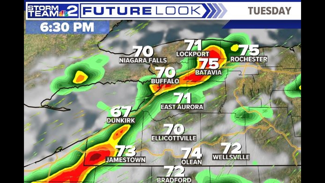
BUFFALO, N.Y. — We’re watching a potential for severe storms with heavy rain, damaging winds, hail or even a brief tornado later today.
A Weather Impact Alert has been issued for today and tonight with this strong storm potential.
A strong cold front will plow through Western New York this evening. Ahead of the front, temperatures will warm into the mid to upper 70s as clouds increase. It will be rather breezy as well.
This afternoon will prove to be an active day as strong to severe thunderstorms are possible at times, mainly at times between 1pm and 9pm.

As a cold front of approaches, strong to severe thunderstorms could occur and all severe weather hazards are possible, including 30% risk damaging winds of at least 60 mph, and 15% risk large hail as the main threats.
There is also a low possibility 5% risk of a brief tornado spin up as well (usually weak), especially across the Southern Tier inland. Areas just south of Buffalo and inland to Batavia and south are in a higher enhanced risk for these severe weather hazards, under the Storm Prediction Center.
There’s a lower slight risk chance for Buffalo and north of city with mainly damaging winds from these storms. Worth keeping a close eye on.
The storms should pass through by overnight tonight leading too much cooler weather on Wednesday but dry.

We’ll have LIVE coverage of the storm beginning at 2:55p on WGRZ +. Download on your TV. Watch for free.