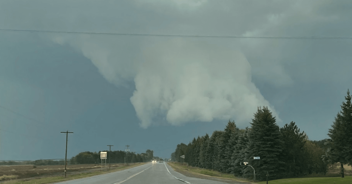
The severe weather threat that we’ve been discussing daily for the past week has arrived and dangerous storms are still on track to happen in Minnesota, Wisconsin and Iowa on Monday.
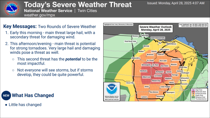
“A regional severe weather outbreak still appears possible across the Upper Midwest, with a threat of strong to intense tornadoes, very large hail, and swaths of damaging winds,” said NOAA’s Storm Prediction Center (SPC) in an update issued at 7:37 a.m. Monday.
NWS Twin Cities
NWS Twin Cities

After morning storms move out of the area, the atmosphere will be primed for explosive development and the SPC expects storms to erupt near the South Dakota, Minnesota, Iowa borders between 1-3 p.m. CT. Those storms will then march to the east, bringing a threat for damaging winds, very large hail and tornadoes.
“This environment will be conditionally favorable for long-track supercells with strong/intense tornado potential if a discrete mode can be maintained,” the SPC warns.
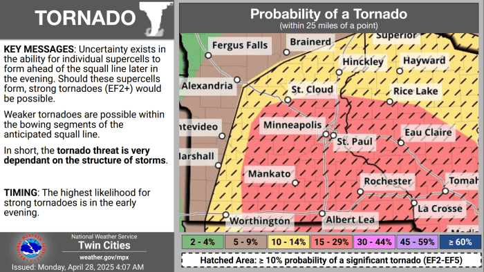
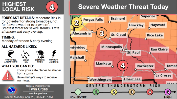
NWS Twin Cities
NWS Twin Cities

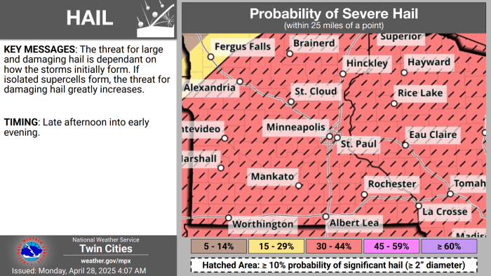
The Weather Channel’s famous Torcon Index has the Twin Cities metro at a 7 on a scale that maxes out at 10.
The Twin Cities office of the National Weather Service lays out what could happen really well in today’s forecast discussion. For starters, there’s almost certainly going to be a squall line that develops and moves across southern Minnesota during the afternoon, but if discrete cells erupt ahead of that line, then significant tornadoes could occur.
The squall line could still produce tornadoes, but the odds of there being a long-track, strong tornado aren’t as high as they are when supercell storms remain isolated.
You can see in the latest HRRR model that the squall line moves through, but it doesn’t show any discrete cells popping ahead of the line. That doesn’t mean they won’t, and if they do, it could be bad.

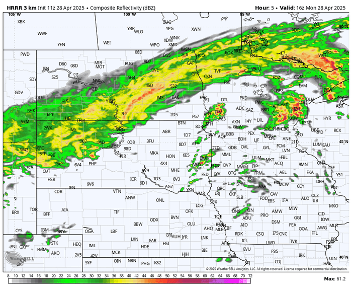
HRRR model’s simulated radar from 11 a.m. to midnight.
WeatherBell
“Fast moving storms will all hazards will evolve into the upper MS Valley later today and tonight. This will be the main show. Still some bust potential with it, but the focus should stay on the TORNADO potential that is driving the moderate risk today from SPC,” says The Weather Channel’s Jim Cantore.
“Supercells or QLCS line will be moving very fast so there will be little time to verify, which as humans we like to do. Just act when a WARNING is issued. Trust the forecaster and just know your safe place.”
We’ll be tracking the situation throughout the day and will be operating a live blog with updates, so check back for the latest.
Bring Me The News