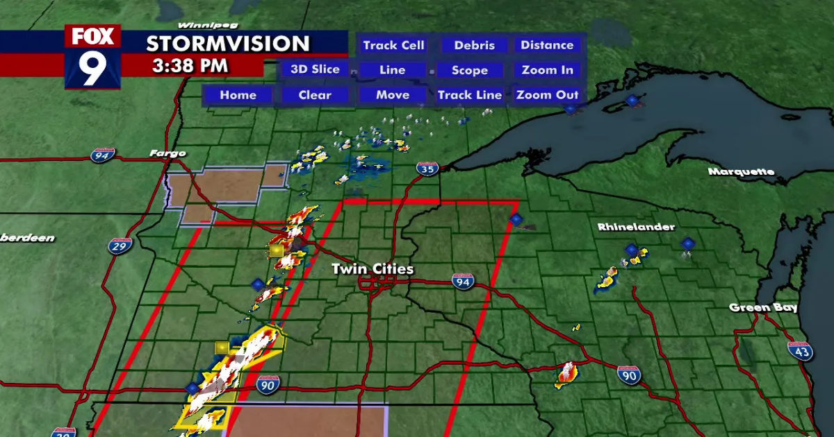
(FOX 9) – Tornado warnings and severe thunderstorm warnings are being issued as severe storms move through Minnesota.
Meanwhile, a tornado watch has been issued for areas west of the Twin Cities metro as Minnesota braces for severe storms set to push through this afternoon and evening.
Watch live coverage in the player above.
Tornado warnings issued
What we know:

Tornado warnings were issued in the following places until 4:15 p.m.:
- Northeastern Meeker County
- Southeastern Stearns County
- Northwestern Wright County
Here are the cities that could be impacted:
- St. Cloud
- Litchfield
- Waite Park
- Rockville
- Clearwater
- Watkins
- Kimball
- Forest City
- Luxemburg
- South Haven
- St. Nicholas
- Fairhaven
- Pleasant Lake
- St. Augusta
Tornado watch issued
What we know:
The National Weather Service issued a tornado watch covering parts of southwestern Minnesota, including Marshall, Willmar, and Hutchinson. The watch also includes parts of northwestern Iowa.

Officials say they anticipate issuing another watch as the storms move east.
The current watch is in effect until 8 p.m. The National Weather Service extended that Tornado Watch to the entire Twin Cities metro, southeastern Minnesota and western Wisconsin until 11 p.m. All types of severe weather are in play, between large hail, strong winds and tornadoes.
What you can do:
As always, officials are warning people to be prepared for severe weather.

To track the storm, get the latest forecast and weather alerts, you can download the FOX 9 Weather app.
You can watch FOX 9 live storm coverage on Channel 9, and streaming on the FOX LOCAL app. FOX 9 is available to watch for free on Roku, Amazon FireTV, Apple TV, Google Android TV and Vizio with the FOX LOCAL app.
You can also stream FOX 9 at fox9.com/live and on the FOX LOCAL Mobile app for your phone, even during a power outage.
Severe weather threat on Monday
The backstory:
The Twin Cities and much of southern Minnesota are at a moderate risk of severe weather.
The storm was expected to come through in two waves. The morning wave was weaker but brought heavy downpours and some small hail, but no major damage.
What’s next:
The afternoon wave of storms is expected to be more severe as a system pushes in from the west in the late afternoon and early evening hours. All severe modes are possible, including large hail, damaging winds and tornadoes. The storms will likely move out of the metro by sunset on Monday.
Storms will quickly develop around 2 p.m. to the west and are expected to move into the metro area in the 4 p.m. to 8 p.m. time frame.

Severe WeatherWeatherMinnesotaWisconsinIowa