A tornado watch spanned eight states on Monday.
A tornado watch spans the Midwest on Monday, putting millions of Americans on alert — even as severe weather, including wind and hail, continues to batter those areas from a system that moved in over the weekend.
The weather conditions pose a moderate risk for northern Iowa, eastern Minnesota — including Minneapolis — and western Wisconsin. These areas face the greatest likelihood for strong tornadoes, very large hail and destructive thunderstorm wind. They are on tornado watch through 11 p.m. CT Monday.
Parts of Missouri, Nebraska, Kansas, Texas and Oklahoma are also on tornado watch, with wind expected to reach up to 75 mph. That includes Des Moines and Topeka and lasts through 11:59 p.m. CT Monday.

Enhanced risks are also in place from Kansas City, Missouri, to Green Bay, Wisconsin; from Duluth, Minnesota, to Sioux Falls, South Dakota.
There is also a slight risk for severe weather in place from west Texas to the western Great Lakes, including Oklahoma City.

Destructive winds and tornadoes are possible in the Upper Midwest on Monday, April 28, 2025.
More than 60 million Americans were on alert for severe weather from Texas to the Great Lakes on Sunday and Monday.

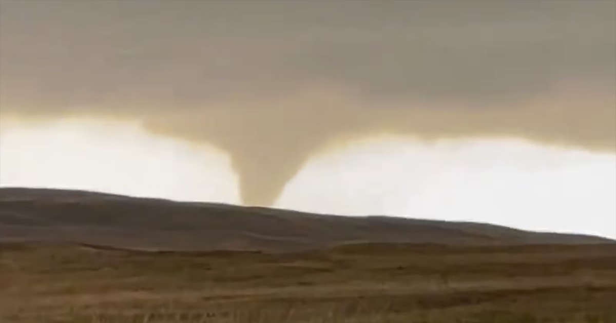
On Sunday, 10 tornadoes were reported in western Nebraska — along with hail larger than baseballs. Near Hyannis, Nebraska, a train was derailed by a tornado, according to the Nebraska State Patrol.
Additionally, locations in both Texas and South Dakota reported wind gusts reaching 75 mph.

The possibility for severe weather continues on Tuesday, with an enhanced risk in place from central Ohio to western New York. Damaging wind, tornadoes and large hail are all possible in these areas. A slight risk for severe storms is also in place from western Texas all the way up to northern Vermont.
A moderate risk for excessive rainfall is also in place over northern Texas, central Oklahoma, southeast Kansas and southwestern Missouri starting Tuesday afternoon and continuing into Tuesday evening.


Up to 7 inches of rain, large hail, strong winds and possible tornadoes are likely in these areas, causing a heightened risk of flooding to Oklahoma and northern Texas, where heavy rain already occurred throughout the weekend.
One person died on Saturday due to the flash flooding in Oklahoma, according to police. Highly saturated top-soil and local streams running at high levels increases the risk for additional flash flooding in the area after these incoming storms.

Going into Wednesday, a moderate risk for excessive rainfall will be focused on eastern Oklahoma and western Arkansas, potentially bringing additional heavy rain, which will continue the enhanced threat for flash flooding.