- Highs in the upper 70s today
- Not as warm Tuesday
- A nice weekend forecast
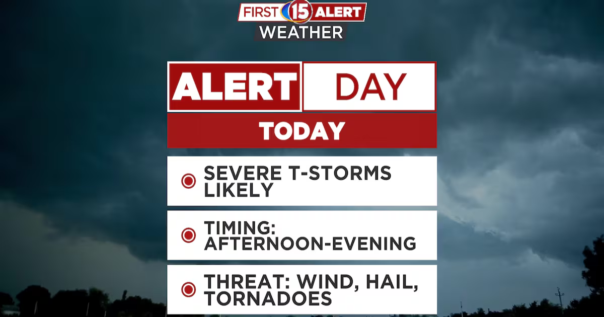
MADISON, Wis. (WMTV) – Strong to severe thunderstorms are expected to develop today. We may get several rounds of strong to severe thunderstorms as a strong wave of low pressure makes its way in from the west.
Atmospheric instability will be on the increase through the morning and afternoon hours as temperatures rise into the upper 70s. Humidity levels will be fairly high as well with low level moisture streaming in on southerly wind.
The biggest threats during the severe thunderstorm outbreak are damaging, wind and large hail. There is also a threat of tornadoes developing as a squall line makes its way across the state of Wisconsin late this afternoon and this evening. Heavy rainfall and frequent lightning can be expected as well.
Today has been declared a First Alert Weather Day by WMTV meteorologists.


Strong to severe thunderstorms are expected to develop today and tonight. Damaging wind, large hail and tornadoes will be possible.(wmtv)

What’s Coming Up…
By tomorrow, quieter conditions are anticipated. We may have a lingering shower early in the morning, but other than that, partly cloudy skies and breezy conditions are expected. Temperatures will be cooler and humidity levels will be much lower.
Another round of rain is expected a little later this week. Showers and thunderstorms are going to be likely on Thursday, though nothing severe is anticipated.


Looking Ahead…
At this point the weekend is looking quiet and dry. High pressure will be dominating the weather bringing plenty of sunshine for Friday, Saturday and Sunday. Temperatures will be near or a little bit above average. Highs are expected in the 60s through the weekend and into the first part of next week.

Click here to download the WMTV15 News app or our WMTV15 First Alert weather app.
Copyright 2025 WMTV. All rights reserved.