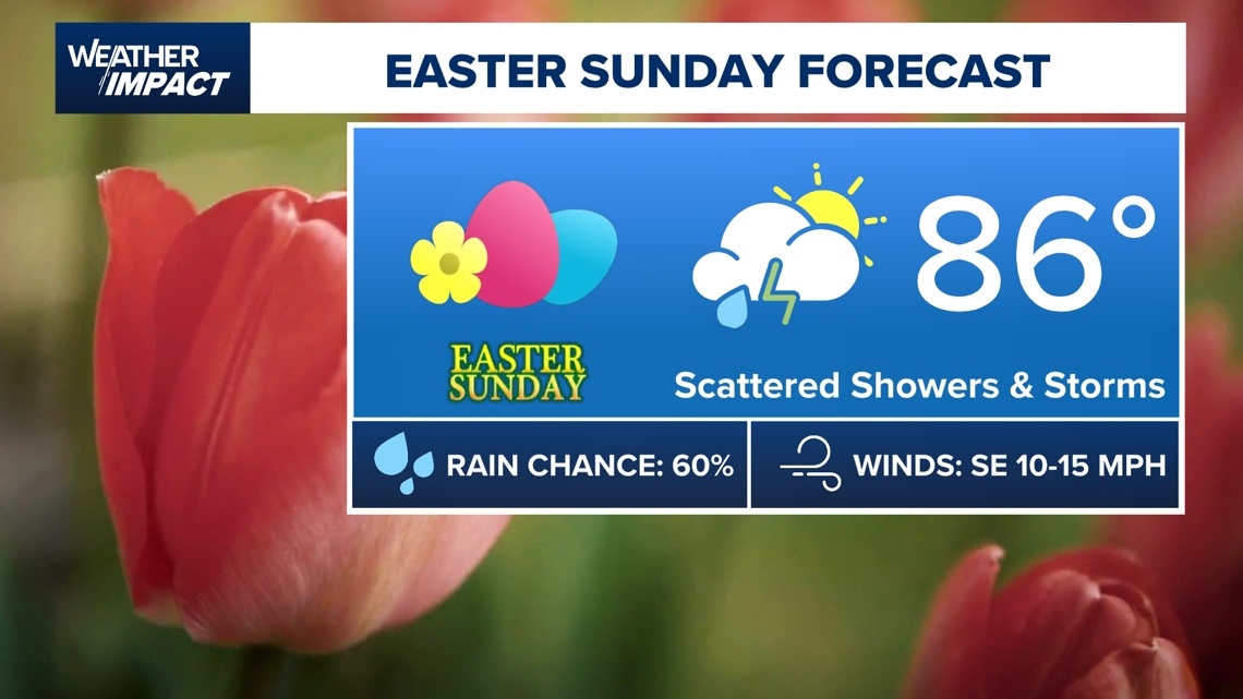
HOUSTON — As the saying goes, “April showers bring May flowers,” and there is rain in the forecast for Houston on Easter Sunday.
Whether you are planning to race to your local park to snag that coveted gazebo or planning to have a backyard barbeque, you might need to have a plan B indoors for Easter activities on Sunday.
Why is Easter Sundays in Houston a hit-or-miss when it comes to the weather?
As Easter typically lands between late March and mid-April, this aligns with a transitional phase in Houston’s climate. Spring in Houston is the period when we transition from cold winter temperatures to hot and humid summer temperatures. During this time, incoming weather systems can throw curveballs and bring “a luck of the draw” of a weather forecast.


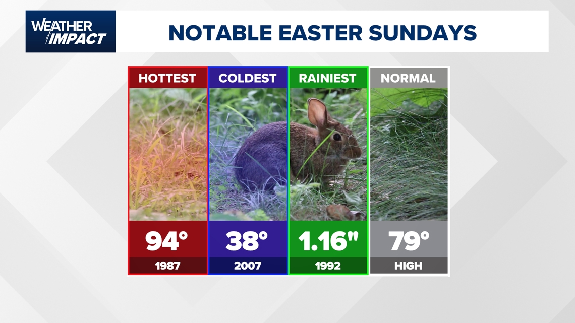
One of the notable Easter Sundays in Houston’s weather history includes one of the warmest which occurred on April 18, 1987, when the afternoon high was 94 degrees.
We might assume we are out of the woods of drastic cold blasts, it’s not uncommon for strong cold fronts to sweep through Texas in the month of April. Flashback to the bitterly cold and rainy Easter Sunday on April 8, 2007, when the morning low temperature was 37 degrees at Bush Airport and the afternoon high was 56°. 1/2″ of rain was also recorded on that day.
One of the rainiest Easter Sundays occurred on April 19, 1992, when 1.77″ of rain was recorded in Houston.

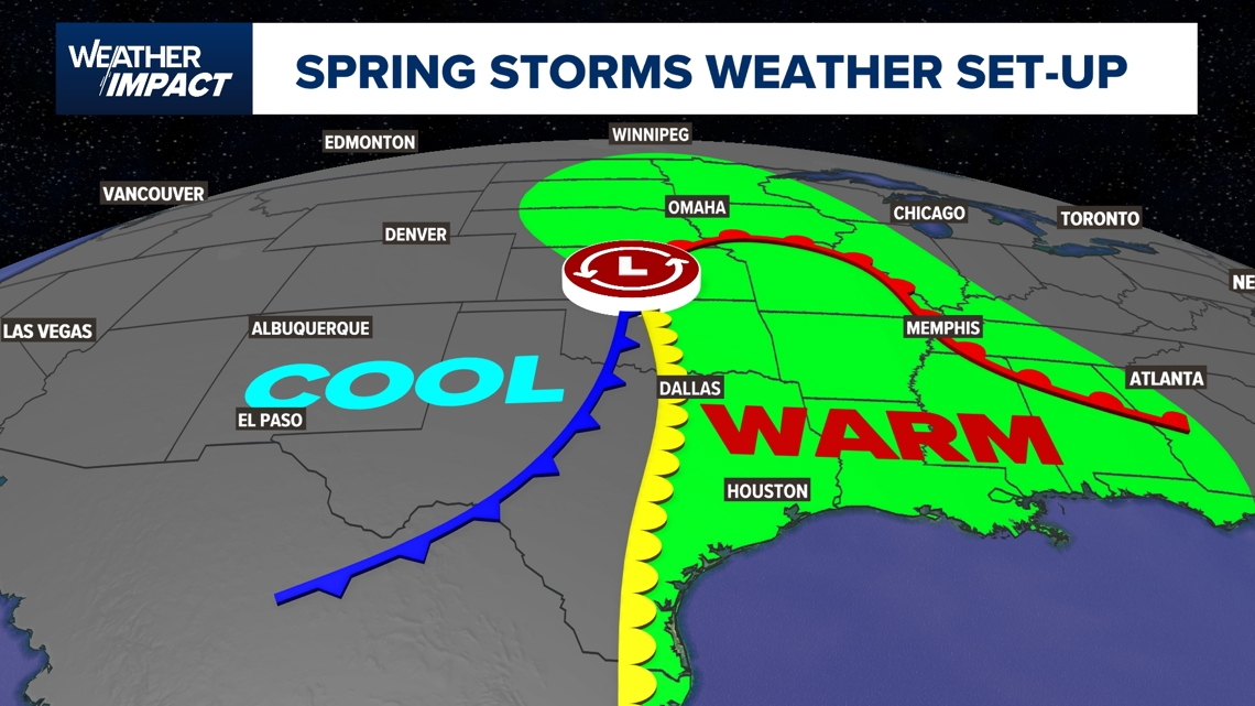
During the spring season in southeast Texas, we usually have a strong southerly surface wind bringing in moisture from the Gulf. Have you noticed it has been breezy lately? This is because the low-level jet stream is rapidly transporting moisture and warmer temperatures northward.


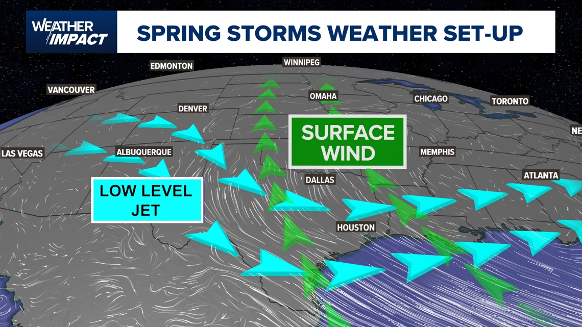
When you add in an incoming upper-level low pressure system, which essentially is a dip in the upper-level jet stream, this creates something called vertical wind shear. Vertical wind shear is the change in the direction of wind and/or speed as you go higher in the atmosphere. This creates the perfect ingredient for storms that could spawn tornadoes. The warm low-level jet during this time of year fuels thunderstorm development.
Hence, the reason why incoming upper-level low pressure systems arriving in the springtime in Texas gives us our severe weather season. Severe weather season in Texas runs from mid-March through mid-June.

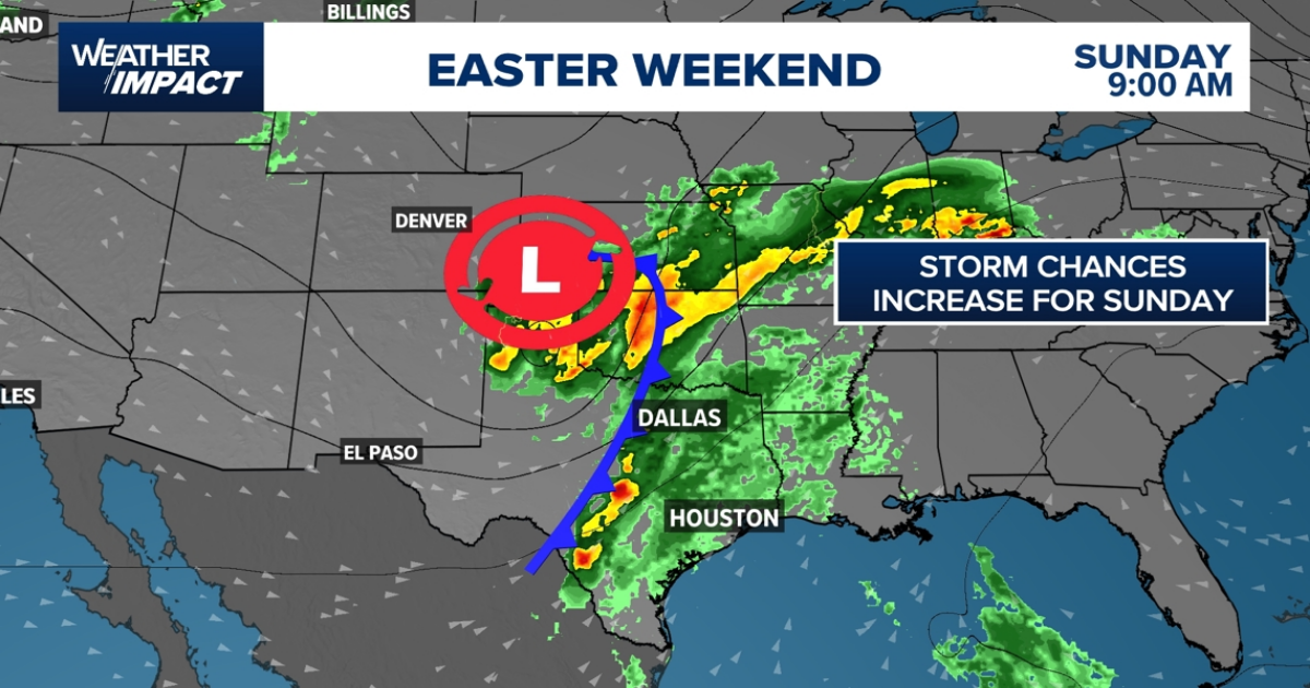
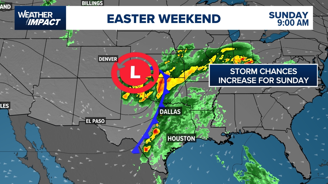
As you are heading across Texas for Easter weekend, keep in mind that an incoming upper-level low pressure system, previously discussed will be moving into Texas and will bring a severe weather risk to a large portion of the state.
Expect a frontal boundary to bring rain and storms in the early hours of Easter Sunday for central Texas and arriving in Houston by Sunday afternoon.


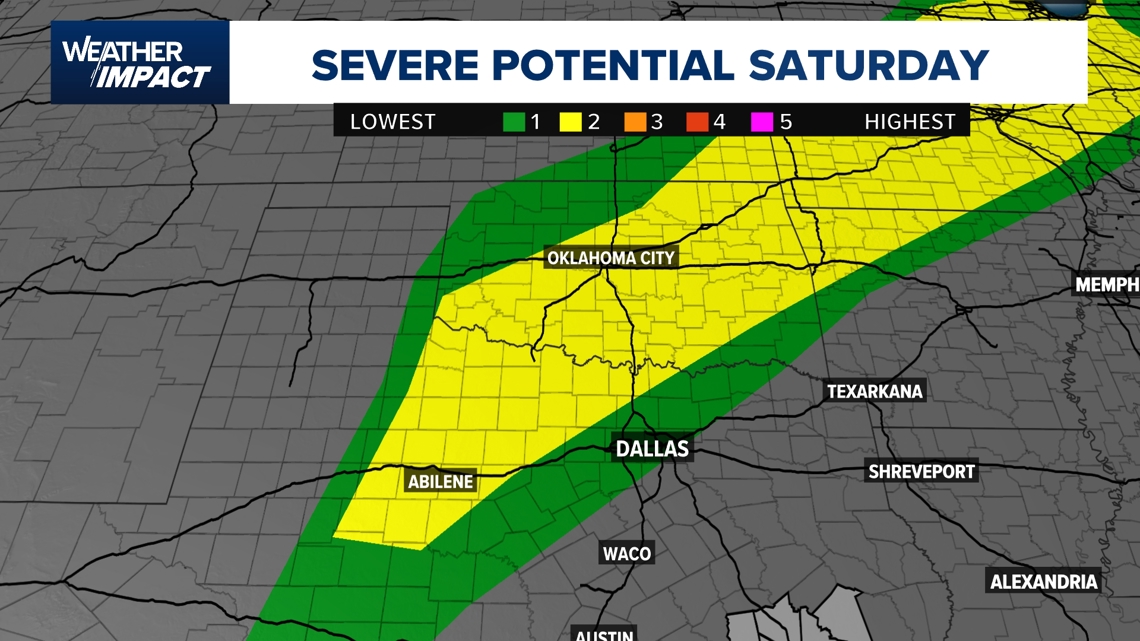
If you have travel plans, the Storm Prediction Center has highlighted a portion of Texas under a Slight Risk for severe weather as this system sweeps into the state on Saturday. This includes the I-20 corridor from Fort Worth to Abilene.

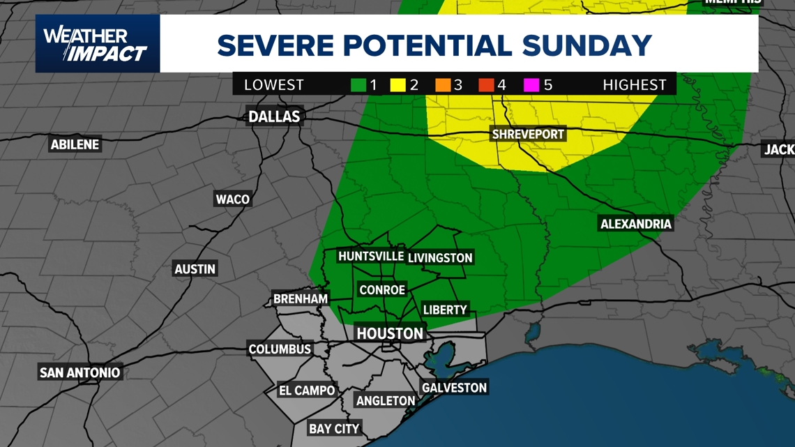
Although the severe weather risk for Houston is on the lower end, on Sunday our northeastern counties will be under a Marginal Risk for severe weather (1 out of 5). We could see isolated strong storms flare up from northern Harris County and northward for Sunday afternoon. This includes Spring, The Woodlands, Conroe, Livingston, and Huntsville. Scattered showers and gloomy skies are still in the forecast from Houston to Galveston.

Heading into next week, the weather pattern will remain unsettled with rain and storm chances in the picture for most of the week. We will have to keep an eye on the possibility for a few strong storms by mid-week.