Severe storms moving through Nebraska, Iowa on Thursday evening
 Updated: 7:18 PM CDT Apr 17, 2025
Severe storms moving through Nebraska, Iowa on Thursday evening
Updated: 7:18 PM CDT Apr 17, 2025

Severe storms are moving through eastern Nebraska and western Iowa on Thursday evening.A tornado warning has been issued for the following counties: Until 7:30 p.m. Northern Douglas County Washington CountyPottawattamie CountyUntil 8 p.m.Cass County, NebraskaA destructive severe thunderstorm warning has been issued in Washington County.The National Weather Service has issued a tornado watch that will be in effect until midnight for the following counties in Nebraska: In NebraskaBurtButlerCassClayColfaxCumingDodgeDouglasFillmoreGageHamiltonJeffersonJohnsonLancasterMerrickNuckollsOtoePlattePolkSalineSarpyThayerThurstonWashingtonYorkIn IowaAdamsAudubonCarrollCassCrawfordFremontHarrisonMillsMononaMontgomeryPagePottawattamieShelbyTaylorA cold front will be moving through the area during the evening and will bring the chance for strong to severe storms mainly between 5 p.m. and 10 p.m. As of Thursday morning, the Storm Prediction Center has most of the KETV viewing area in an enhanced risk zone for severe storms.Where storms develop after 5 p.m., it’s likely they will become severe, though most will likely miss out on storm activity. Very large hail would be the main threat with any severe storms. There’s still a chance for damaging wind gusts and can’t rule out one or tornadoes. Stay weather aware Thursday evening if you have plans outdoors. Looking ahead, your Easter Sunday plans may be impacted by wet weather. While it doesn’t look like a complete washout, rain chances are likely during the day. No severe weather is expected. Stay up to date with the latest severe weather forecast by downloading the KETV mobile app.NAVIGATE: Home | Weather | Local News | National | Sports | Newscasts on demand |
Severe storms are moving through eastern Nebraska and western Iowa on Thursday evening.
A tornado warning has been issued for the following counties:
Until 7:30 p.m.

- Northern Douglas County
- Washington County
- Pottawattamie County
Until 8 p.m.
A destructive severe thunderstorm warning has been issued in Washington County.
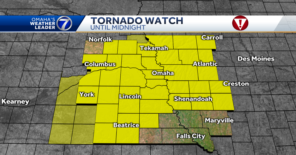
The National Weather Service has issued a tornado watch that will be in effect until midnight for the following counties in Nebraska:
In Nebraska

- Burt
- Butler
- Cass
- Clay
- Colfax
- Cuming
- Dodge
- Douglas
- Fillmore
- Gage
- Hamilton
- Jefferson
- Johnson
- Lancaster
- Merrick
- Nuckolls
- Otoe
- Platte
- Polk
- Saline
- Sarpy
- Thayer
- Thurston
- Washington
- York
In Iowa
- Adams
- Audubon
- Carroll
- Cass
- Crawford
- Fremont
- Harrison
- Mills
- Monona
- Montgomery
- Page
- Pottawattamie
- Shelby
- Taylor

A cold front will be moving through the area during the evening and will bring the chance for strong to severe storms mainly between 5 p.m. and 10 p.m. As of Thursday morning, the Storm Prediction Center has most of the KETV viewing area in an enhanced risk zone for severe storms.

Where storms develop after 5 p.m., it’s likely they will become severe, though most will likely miss out on storm activity. Very large hail would be the main threat with any severe storms. There’s still a chance for damaging wind gusts and can’t rule out one or tornadoes. Stay weather aware Thursday evening if you have plans outdoors.
Looking ahead, your Easter Sunday plans may be impacted by wet weather. While it doesn’t look like a complete washout, rain chances are likely during the day. No severe weather is expected.
Stay up to date with the latest severe weather forecast by downloading the KETV mobile app.
NAVIGATE: Home | Weather | Local News | National | Sports | Newscasts on demand |