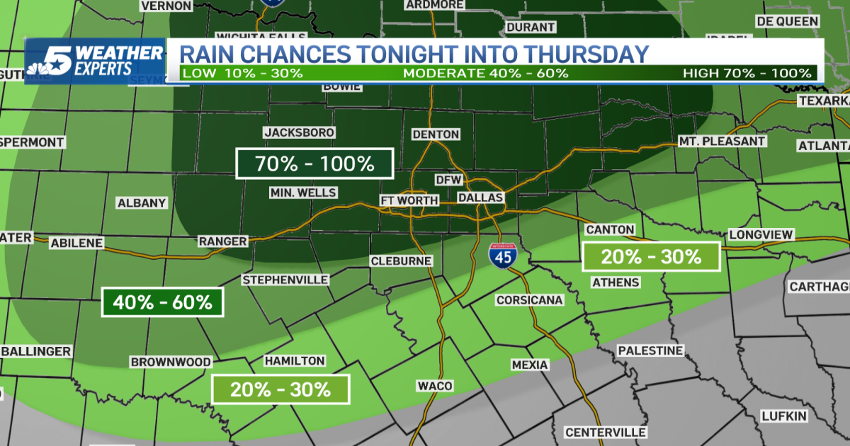
An active pattern is setting up across North Texas for the rest of the week with rounds of rain and storms.
The first round of stormy weather arrived Wednesday morning.

Additional storms will develop late Wednesday into Thursday morning. The Storm Prediction Center has much of North Texas included in a level 3 risk for severe weather.


The heaviest rain is set to arrive Friday into Saturday morning.

Rain totals could exceed 2 inches in some locations, with the highest rain total expected in locations north and east of DFW.

By Sunday, the pattern begins to dry out, with sharply cooler air pushing in behind a cold front.
Below-normal temperatures will stick around for a couple of days, featuring lows in the 40s and highs only in the 60s.


