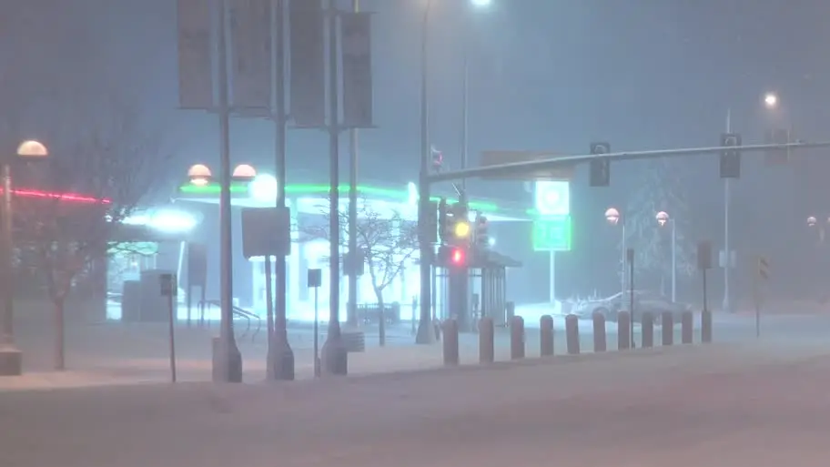
MINNEAPOLIS (FOX 9) – The March snowstorm is officially the largest snowfall of the season in the Twin Cities.
Largest snowfall of the season at MSP Airport
Local perspective:
As of 6 a.m., Minneapolis-St. Paul International Airport has picked up 7.4 inches of snow. This marks the largest snowstorm of the season for the Twin Cities. It is still snowing, so this snow total could go up.
Here’s a look at how much it has snowed at MSP Airport this season:

- March 4-5 storm: 7.4 inches (as of 6 a.m., but this number will be higher as it is still snowing. The next update will be at noon.)
- Dec. 19 storm: 5.5 inches
- Feb. 8 storm: 3.3 inches
- Feb. 14 storm: 1.7 inches
All other snow events in the Twin Cities this season recorded less than an inch of snow at MSP Airport.
Snow totals in Minnesota
By the numbers:
Here’s a look at some snow totals on Wednesday. Note: The snow is still falling, so these snow totals will be updated and could change.
- Dennison: 13 inches (as of 7:30 a.m.)
- Elko New Maret: 11.5 inches (as of 6 a.m.)
- Apple Valley: 11 inches (as of 7 a.m.)
- Ellendale: 10.2 inches (as of 6 a.m.)
- Northfield: 10 inches (as of 7:30 a.m.)
- Lakeville: 10 inches (as of 7:30 a.m.)
- Prior Lake: 9.5 inches (as of 7:30 a.m.)
- Woodbury: 9.3 inches (as of 6 a.m.)
- Apple Valley: 8.5 inches (as of 6 a.m.)
- Owatonna: 9 inches (as of 7:30 a.m.)
- Inver Grove Heights: 9 inches (as of 7:30 a.m.)
- Stillwater: 9 inches (as of 7:30 a.m.)
- Oakdale: 8.5 inches (as of 6 a.m.)
- Nye, Wisconsin: 8.5 inches (as of 7:30 a.m.)
- Rosemount: 8.5 inches (as of 7:30 a.m.)
- Burnsville: 8.2 inches (as of 7:30 a.m.)
- New Brighton: 8.2 inches (as of 7:30 a.m.)
- St. Anthony: 8 inches (as of 6 a.m.)
- Savage: 8 inches (as of 6 a.m.)
- Hastings: 8 inches (as of 6 a.m.)
- River Falls, Wisconsin: 8 inches (as of 6 a.m.)
- Downtown St. Paul: 8 inches (as of 7:30 a.m.)
- Edina: 8 inches (as of 7:30 a.m.)
- Albert Lea: 8 inches (as of 7:30 a.m.)
- Hugo: 7.8 inches (as of 7:30 a.m.)
- White Bear Lake: 7.5 inches (as of 7:30 a.m.)
- Shoreview: 7.5 inches (as of 7:30 a.m.)
- Mankato: 7.5 inches (as of 7:30 a.m.)
- MSP Airport: 7.4 inches (as of 6 a.m.) — the largest snowfall of the season
- Fridly: 7.3 inches (as of 7:30 a.m.)
- Richfield: 7.2 (as of 6 a.m.)
- Cottage Grove: 7.2 inches (as of 7 a.m.)
- Eden Prairie: 7 inches (as of 6 a.m.)
- Downtown Minneapolis: 7 inches (as of 7:30 a.m.)
- Amery, Wisconsin: 6.8 inches (as of 7:30 a.m.)
- Lino Lakes: 6.6 inches (as of 7:30 a.m.)
- Chisago City: 6.5 inches (as of 7:30 a.m.)
- Chanhassen: 6.5 inches (as of 6 a.m.)
- Victoria: 6.1 inches (as of 7:30 a.m.)
- Roseville: 6 inches (as of 7:30 a.m.)
- Coon Rapids: 5.6 inches (as of 6 a.m.)
- Blaine: 5.6 inches (as of 7:30 a.m.)
- Menomonie: 5 inches (as of 7:30 a.m.)
- North Branch: 4.7 inches (as of 6 a.m.)
- Robbinsdale: 4.6 inches (as of 7:30 a.m.)
- Anoka: 4.5 inches (as of 6 a.m.)
- Plymouth: 4.2 inches (as of 7:30 a.m.)
- Corcoran: 4 inches (as of 7 a.m.)
- Long Lake: 4 inches (as of 7:30 a.m.)
- Rochester: 3.5 inches (as of 6 a.m.)
- Oak Grove: 3 inches (as of 6 a.m.)
- Glencoe: 2.7 inches (as of 7:30 a.m.)
- Monticello: 2.5 inches (as of 7:30 a.m.)
- Marshall: 2.5 inches (as of 7:30 a.m.)
- Sherburne: 2.2 inches (as of 7:30 a.m.)
- Champlin: 2.1 inches (as of 7:30 a.m.)
- Maple Lake: 2 inches (as of 7 a.m.)
- Dassel: 1.8 inches (as of 7;30 a.m.)
- St. Cloud: 0.8 inches (as of 7 a.m.)
- Little Falls: 0.5 inches (as of 6 a.m.)
Send FOX 9 your snow totals, but don’t take a measurement of a drift — try to find the average in your yard or on your deck.

READ MORE: Semi teetering on the edge of snowy overpass in Maplewood
Snowy then sunny in Minnesota
Snow will continue to fall through the morning commute. Wind is also an issue, with gusts upwards of 40 mph in the Twin Cities.
READ MORE: Minneapolis firefighters battle 3-alarm fire during snowstorm
A winter storm warning is in effect for the Twin Cities and much of western Wisconsin, while most of southern Minnesota is under a blizzard warning until Wednesday afternoon.

Heavy snow will taper to lighter snow and then flurries through the morning commute, with snow wrapping up by lunchtime. Difficult travel is expected as the cleanup process continues into the afternoon.
After the snow, it’ll turn sunny Wednesday afternoon, but it’ll stay windy. By Wednesday night, it’ll be cold and quiet, as breezes gradually relax. Thursday will be tranquil and sunny, with a high of around 36 degrees. The angle of the March sun will help melt all this snow.
Winter WeatherMinneapolisSt. Paul